Get real time reporting of your employee/ customer base, directly from the field

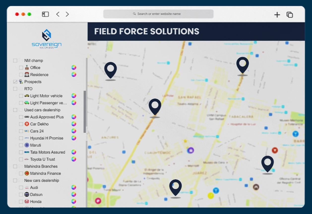
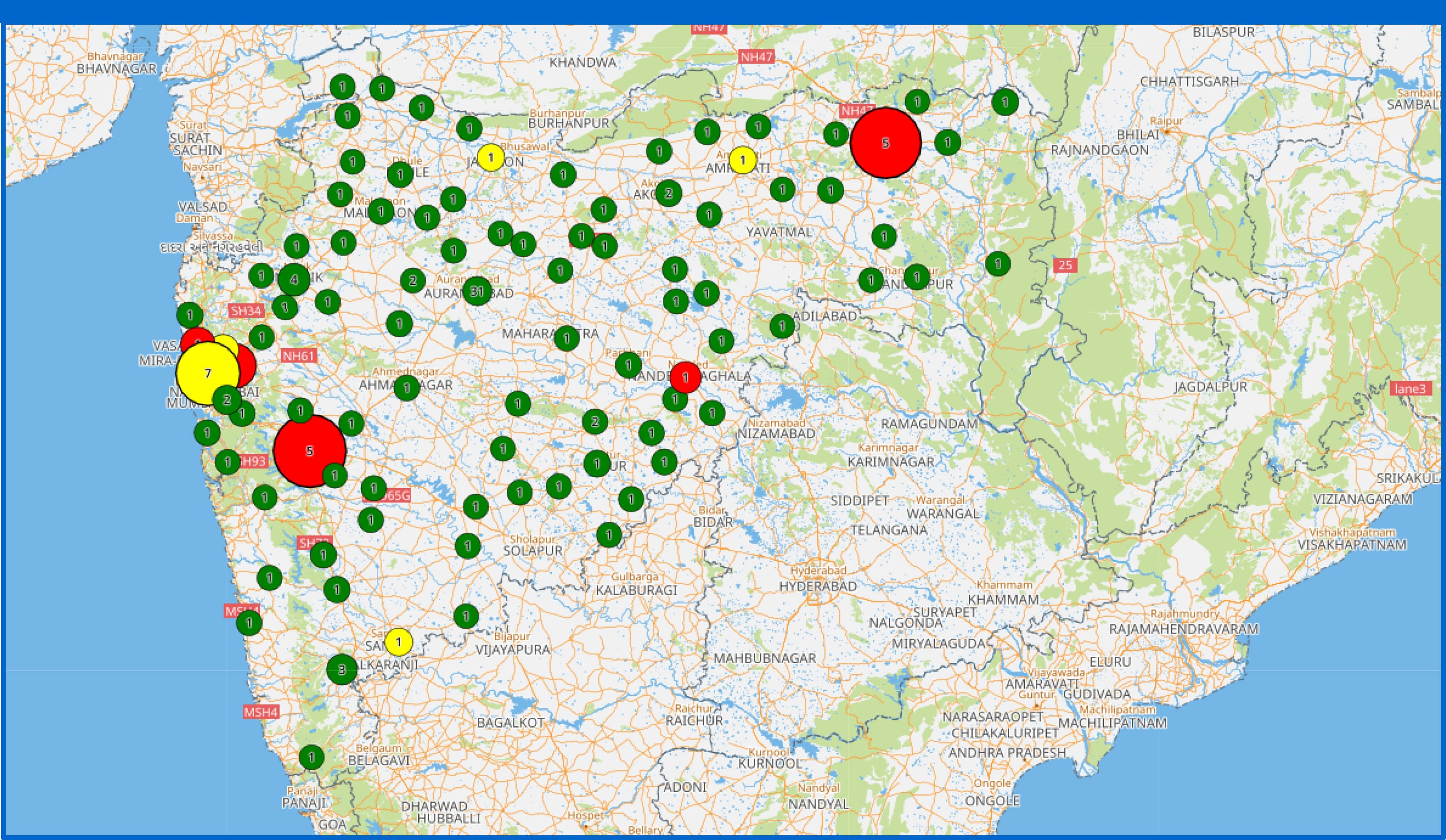
View nearby competitors, customer & other POIs

Review MIS, Performance metrics, KPIs
At the press of a button, you can add new team members or associates to your system and with the same ease, switch them off when your association ends.
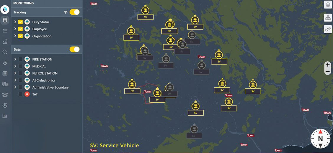
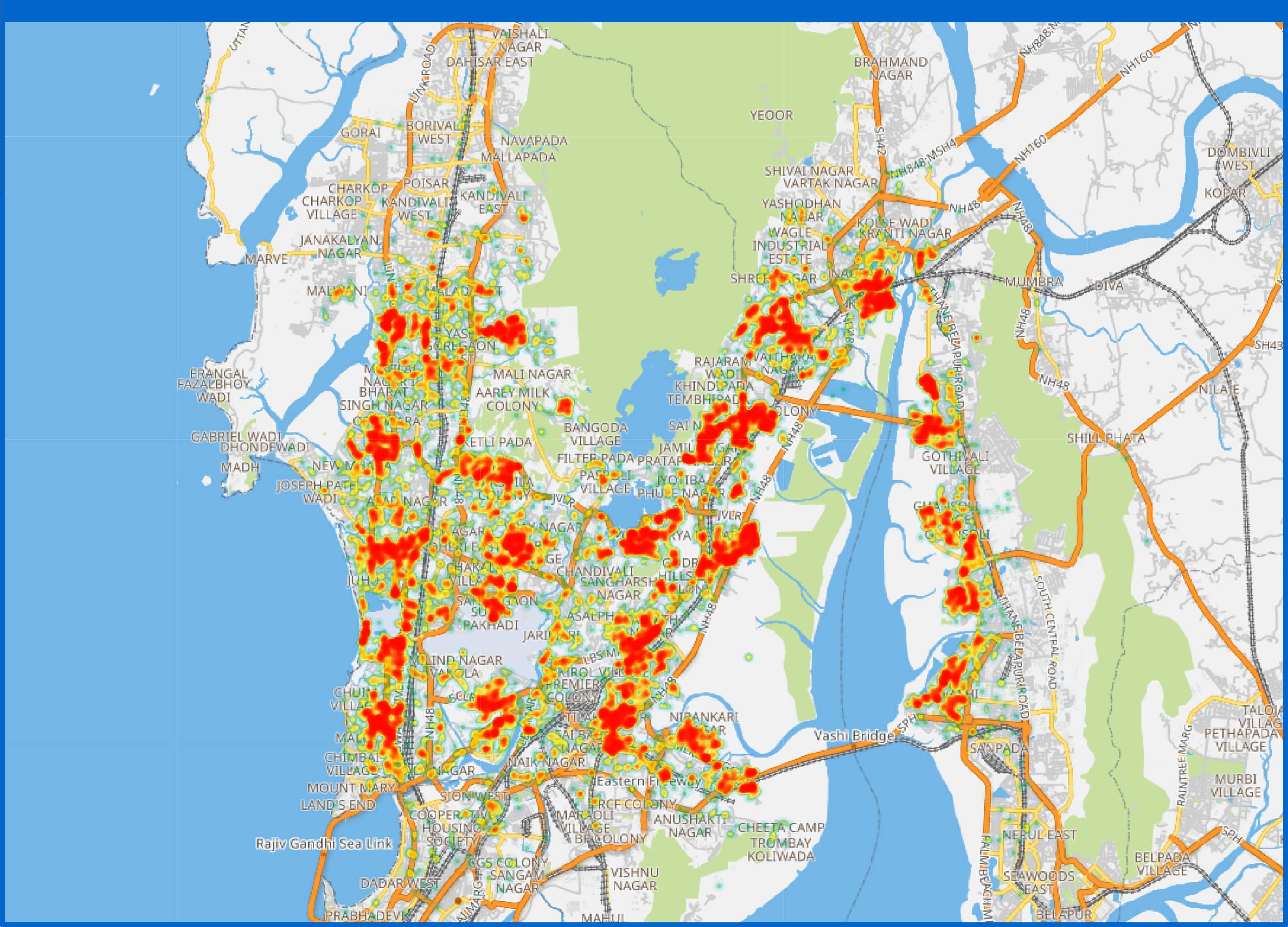
Get to know the exact positions of your logistics, sales teams, partners and their staff, besides your own field force, in depth. Convert this knowledge into business strategies that can transform your operational efficiencies significantly.

Our solution can record and store the activities of all field force team members making it simple and easy for you to verify actions and approve reports or claims.

Get employee's attendance with accurate location & time of punch in/out
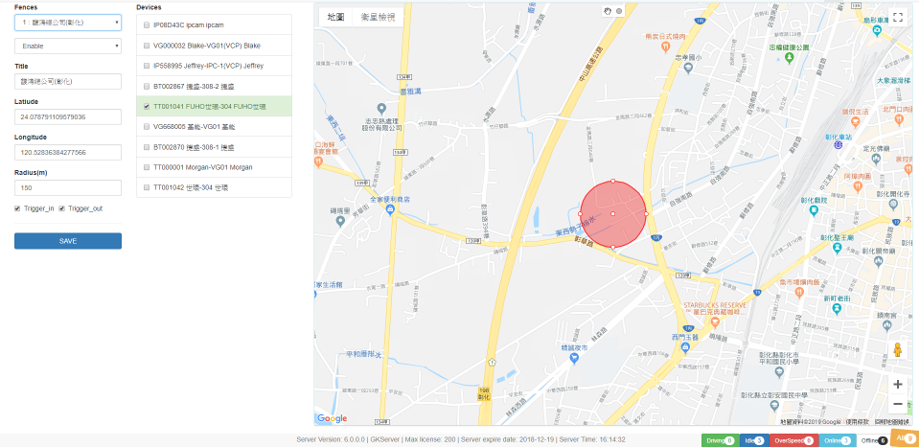
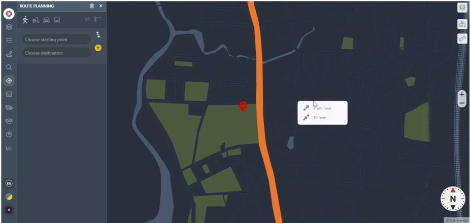
Plan the team beat routes in advance and save time in the field

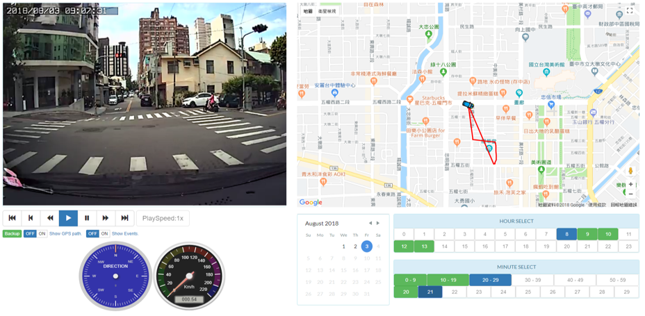
Graphically analyze the daily visit reports/ minutes of meetings
Keep an eye on projects and developments you are associated with on a regular basis. Know their progress from any location, simply through our dashboard.
Our field force management solution supports and stores images, videos and alpha-numeric data, collected at steel level. This information can be routinely, amended and edited based on the changing ground realities. Thus, decision makers at regional and head offices receive updated information, laced with uniquely local flavours.
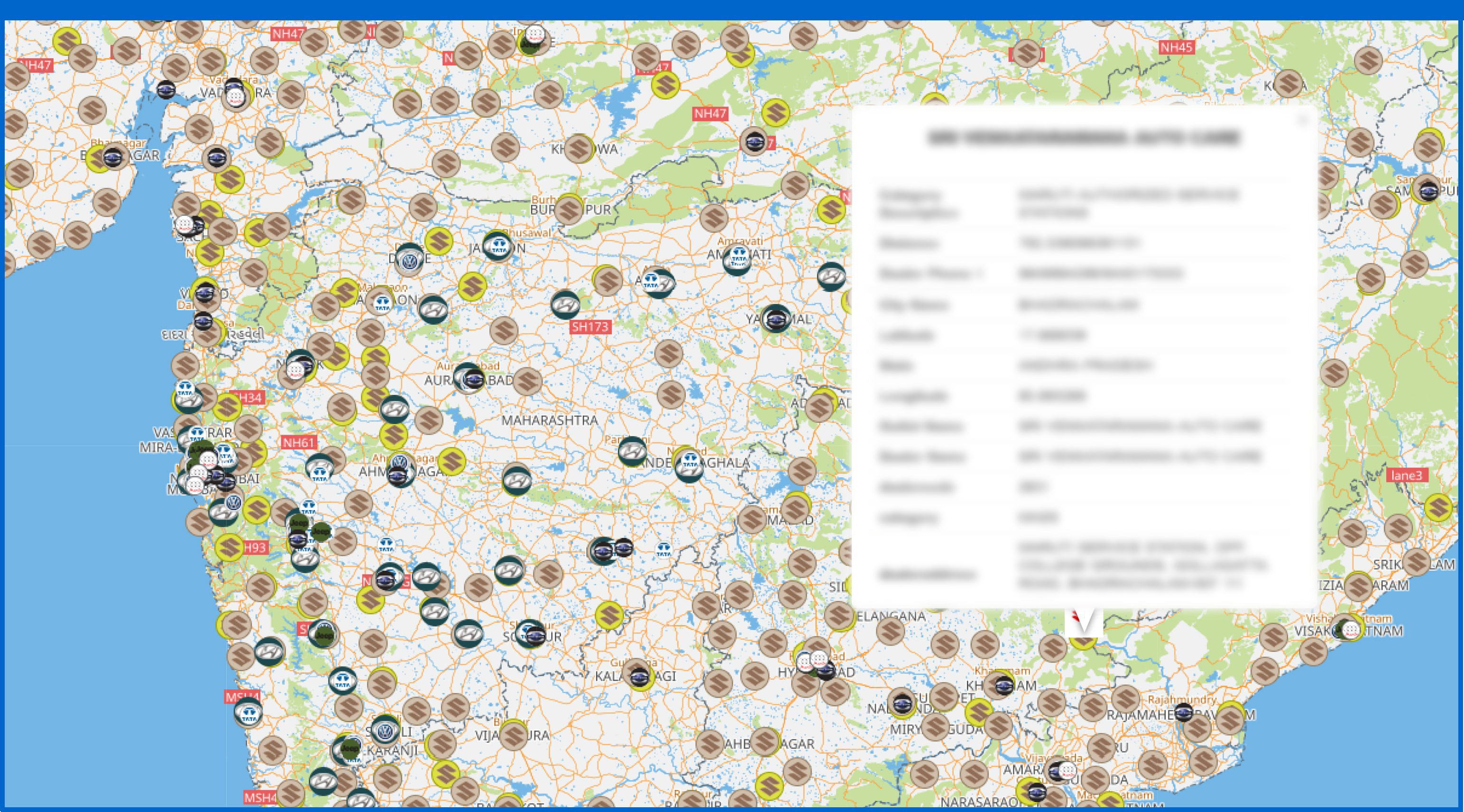
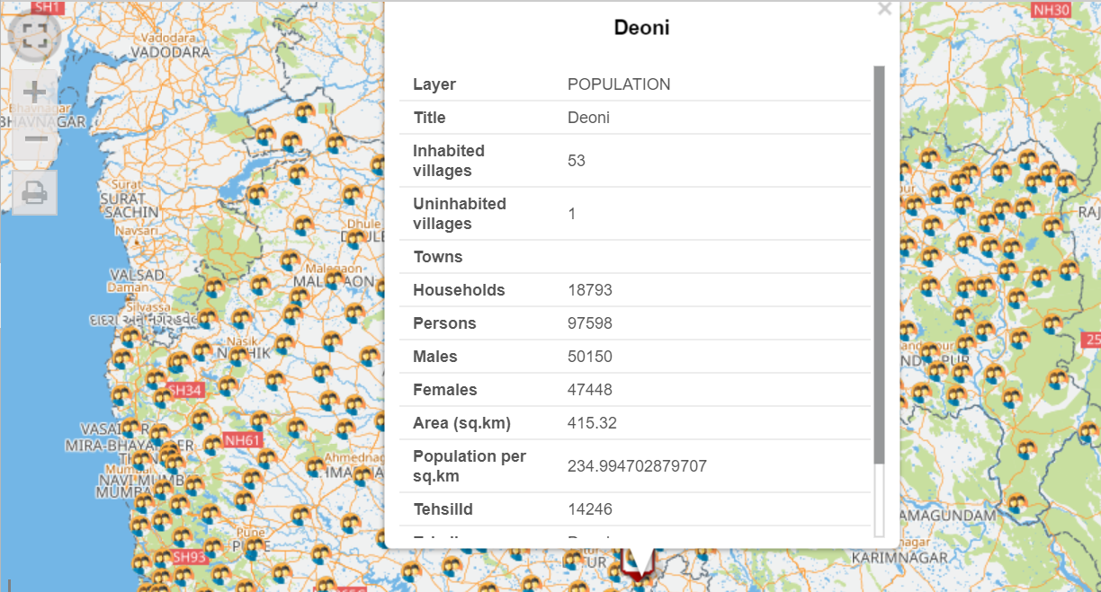
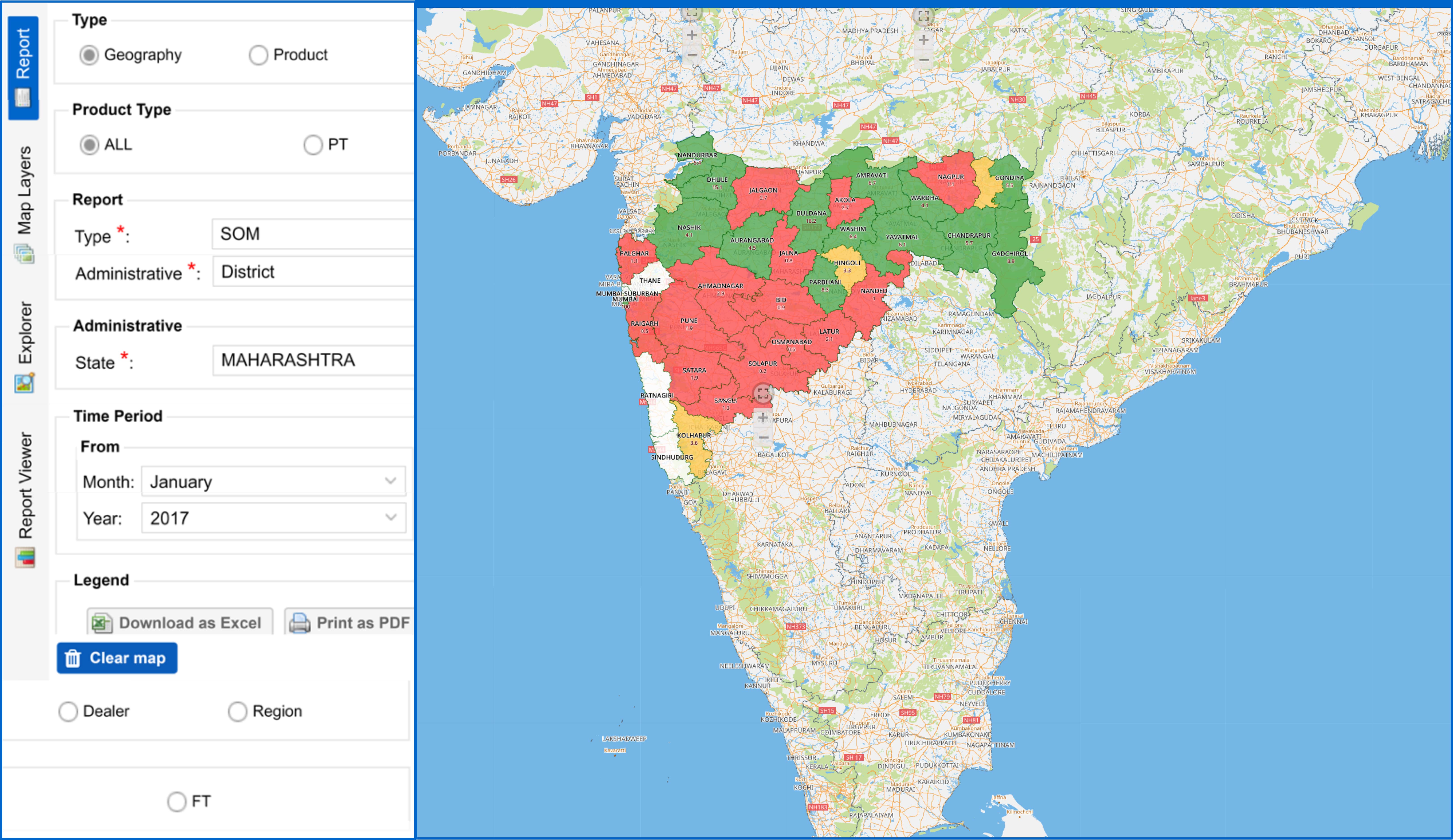 Micro manage your business at subdistrict/pincode/ village
level etc.
Micro manage your business at subdistrict/pincode/ village
level etc.
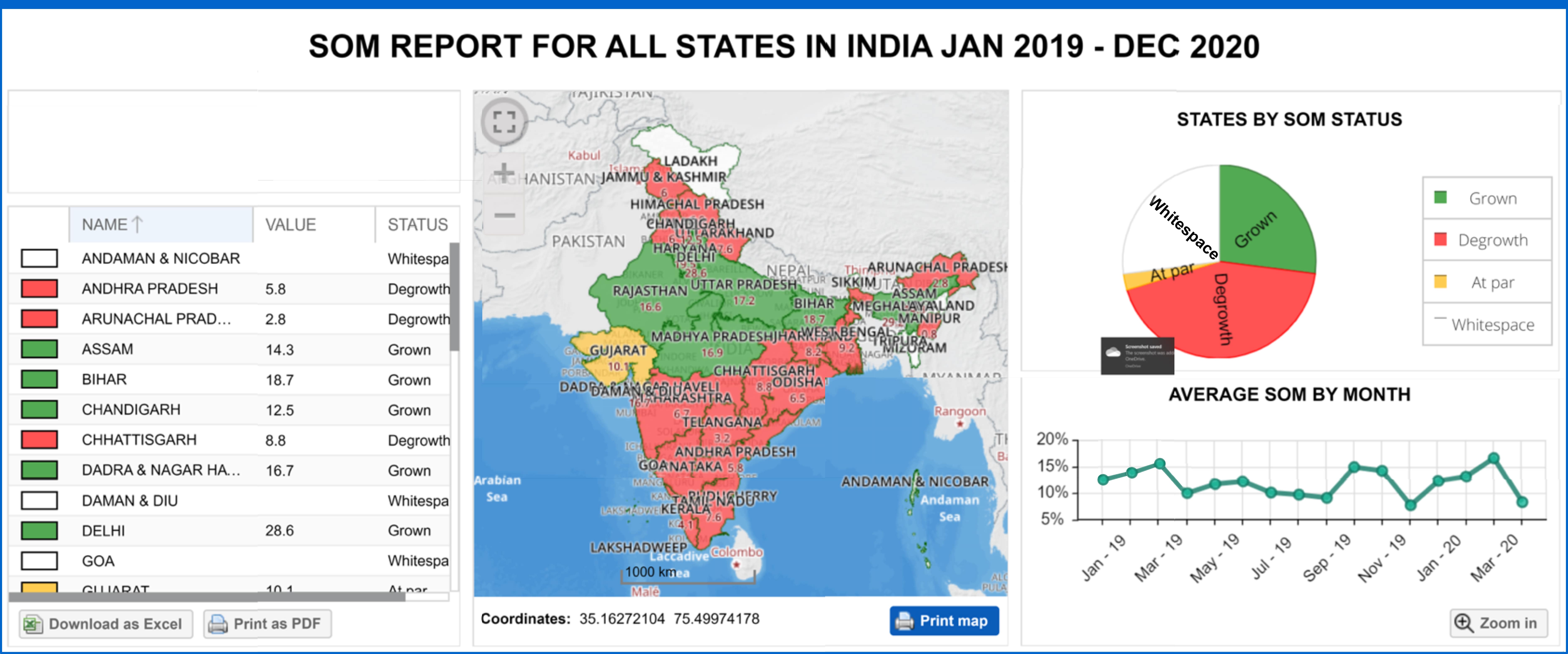 Review MIS, Performance metrics, KPIs